Zonal Development Planning in Rajasthan
Client Requirement:
The basic objectives of Zonal Development plan was:
- To look and provide for the future requirement and present backlog of the Shelters in the city to provide for basic housing needs.
- To look and provide for the basic infrastructure services and basic amenities to the present population of the city and plan for the future population needs as well.
- Not neglecting the conservation, heritage and environment aspects of the city and plan for the upgradation of the quality of the environment in the city.
- To engage the population as a part of various community participation programmes and taking into view the immediate needs and requirements of the population catered by the Urban Local Body.
- The Urban Local Body needs to redevelop the existing infrastructure skeleton present in the city rather than planning extensively for the new development, Much attention is required to attend to the weaker sections of the society and the deprived areas of the city in the Zonal Development Plan.
- The Zonal Development Plan should be a model of integration of various aspects of the city development so that various authorities can work on the plan together as an integrated unit so that there are no alterations in the techniques and timings of different authorities for example, Water and sanitation department should be tuned with the Road and Transportation departme
Solutions Provided:
The following stages has been followed for preparing Zonal Development plan:
Stage – 1: Preparation of detailed Property level Zonal Base Map:
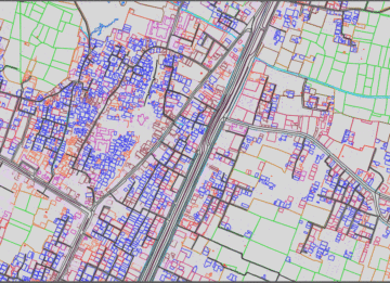
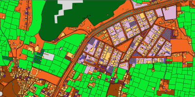
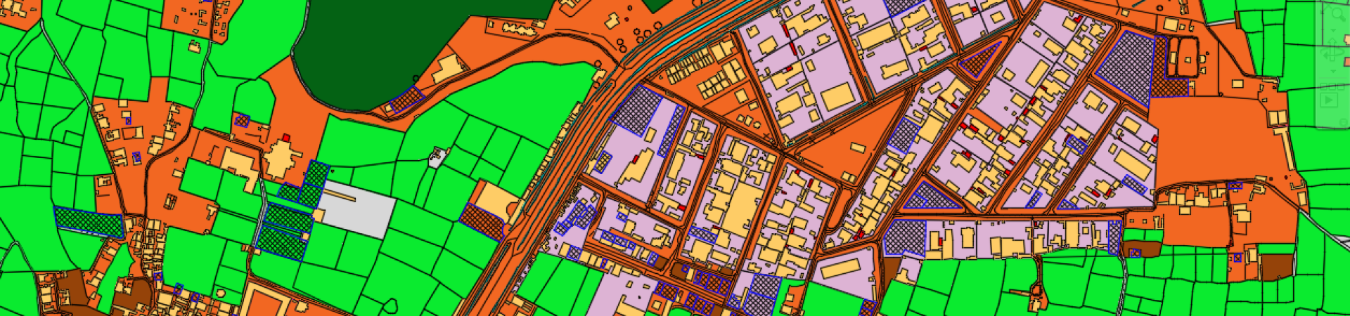
A detailed Zonal Property level Base Map/Existing Land Use was prepared using GIS based Drone & Total Station Survey. After data captured Digital/vector data was prepared using Ortho-mosaic images. The detailed Zonal Property level Map/Existing Land Use will indicate following features;
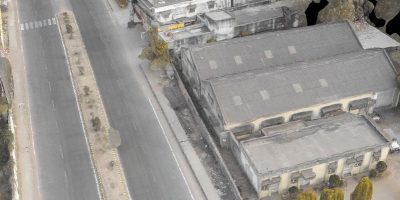
1. All the properties situated in the Master Plan area of the Town, including their Photographs from front and top views.
2. Alignment of all the public Utilities / Services lines which ever visible on ground such as HT/LT lines, GAS, Telephone & Water lines etc.
3. Digital Terrain Model (DTM) and Contours was generated.
4. All the major landmarks of the zones/sectors, including their Photographs & brief information about these land marks was captured.
Various activities was conducted to prepare the property level zonal base map as given below;
1. Establishing ground control point (GCPs) network using DGPS having + 10 mm positional accuracy.
2. Aerial survey using drones having camera of 20 MP to generate Ortho-photo having 4 cm to 6 cm image resolution and 6 cm to 8 cm positional data accuracy
3. DSM and Contour using aerial data
4. On ground survey using Total Station where Drone is not accessible
5. Existing Property & Utility and Landmark digitization using CAD
6. Overlay the cadastral map generated on the aerial data
7. Socio-economic property survey can be done at ground if required and collected data can will be integrated with captured property data from images.
Stage – 2: Superimposition of various existing & surveyed Maps:
A) Data Collection: Following existing Map data was collected from ULBs;
• Collection of Revenue Maps
• Collection & listing of records related to commitments of Approved layout plans, 90-A/90-B Orders, government land allotments etc.
• Collection & listing of records related to government lands, ULBs Lands, Charagah Land, Forest Land, River, Water bodies, Hills etc.
• Collection of Municipal Boundary & ward boundary.
B) Data Creation: Above collected data was geo-referenced using GCPs and will be digitized for vector data formation.
C) Superimposition: All the vector and Raster data collected and digitized was superimposed of Stage 2 Data and final maps was created.
Stage – 3: Ground verification of detailed Base Map and Land Use:
Ground Verification was done under the supervision of Executive Officer of ULB/Town Planner of concerned ULB, Senior most Engineer of ULB and Representative of Revenue Department who has verify the base map as per ground conditions and put a proposal / recommendations for any amendment / changes in the base map. After that these changes was edited or modified in Stage 1 and 2 maps.
Stage – 4: Superimposition of Master Plan & Preparation of Draft Zonal Development Plan:
Superimposition of Master Plan land uses on the final base map, existing Land Use Plan was done and ULB had prepare the Draft Zonal Plan showing road network, area for reservation of water bodies, forests, etc. and zone specific, Provisions, if any.
A brief report was prepared indicating changes in Master Plan-road network plan and consequential minor changes, if any, required due to existing development and commitments. After that these changes was edited or modified in Stage 1, 2 and 3 maps.
Stage – 5: Finalization of Draft Zonal Development Plan:
After receipt of objections/suggestions the Final Zonal Development Plan was prepared with the brief report of any changes/modifications required, if any, in Master Plan to proposed road network and other necessary modifications due to ground conditions. Suggested changes / modifications was incorporated in the data as well which had been created and prepared in Stage 1, 2, 3 and 4.
Conclusion:
The most important need of introducing a master plan in any city is indeed to Future Proof it. As the population of the city and its nearby areas increases, the pressure on the city also increases. A master plan tailors and addresses the growing needs of the city and guides the city’s transportation and utilities plans, future land-use patterns and the locations of economic activity for 20-25 years. A master Plan gives directions for the necessary future actions.